Difference between revisions of "Main Page"
(→{{Fa|fa-user}}ORGANIZATIONS (CUSTOMERS)) |
(→{{Fa|fa-user}}ORGANIZATIONS (CUSTOMERS)) |
||
| Line 260: | Line 260: | ||
** tracks vs. last position modes, grouping options, ordering | ** tracks vs. last position modes, grouping options, ordering | ||
** security features (security delay, zoom restriction, position "rounding") | ** security features (security delay, zoom restriction, position "rounding") | ||
| − | ** presentation and visualization tools (a default map selection, icon/track styles, choice of icons, logos with links, foto gallery) | + | ** presentation and visualization tools (a default map selection, icon/track styles, choice of icons, logos with links, foto gallery) |
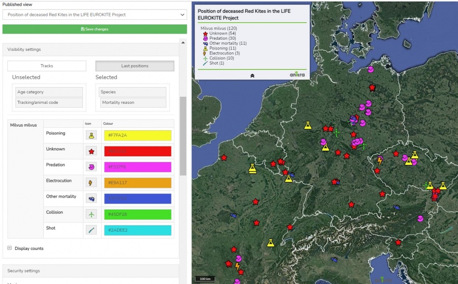
| + | * a map editor with a live preview of the final map can be used to configure the map | ||
| + | <br>[[File:publish_map_configuration_groups.JPG|900px]] | ||
* samples showing some of the map features | * samples showing some of the map features | ||
** map with tracks and gallery: https://app.anitra.cz/share/map/5d2e379ed6f9c | ** map with tracks and gallery: https://app.anitra.cz/share/map/5d2e379ed6f9c | ||
Revision as of 08:26, 27 September 2021
Anitra platform is a comfortable environment to store, visualize and analyze telemetry data and manage even very complex telemetry projects.
The tool is flexible enough to host datasets generated by transmitters of any brand (manual and automatic data feed) however some of the most advanced features are tailored to complement the unique onboard functionality of ANITRA branded GPS-GSMS transmitters only. The very core functionality serves as a device backend for Data Owners/Admins. Data owners can make their data available to other users or even make their data public in a simplified and secured way using an elaborated sharing scheme. Each user can possibly act in both modes (i.e. admin for owned or administered devices and viewer for data shared with him by others). Most of the platform functionality is free of charge and available to anyone. Only large data volumes might be possibly restricted or charged.
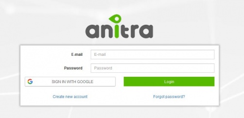
Log in/ Sign up screen of ANITRA platform available at https://app.anitra.cz/
AREAS OF FUNCTIONALITY
Contents
SIGNING IN
Sign up
- Use the "Create new account" link on the login page: https://app.anitra.cz/ to auto-register yourself as a new platform user
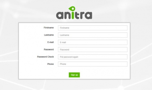
- Use a valid email address as your future username /do not use shared or group emails/
- Enter your name /enter person name, do not use group names, numbers, and similar instead of personal names - important when working in projects with other people/
- Upon completion, an email with an account confirmation link will be sent to your inbox
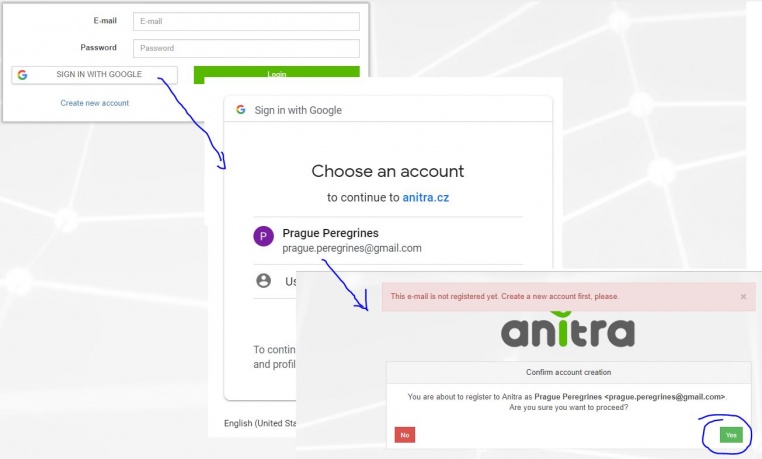
- Alternatively create a new account by using the "SIGN IN WITH GOOGLE" button.
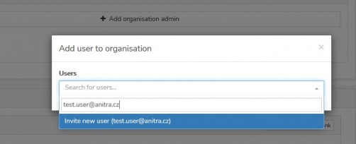
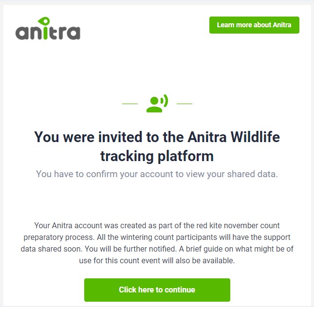
- A new user can also be created by other existing users sending an invitation to the new person from access granting wizards
Sign in
- Once completely registered you can log in
Password reset
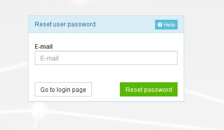
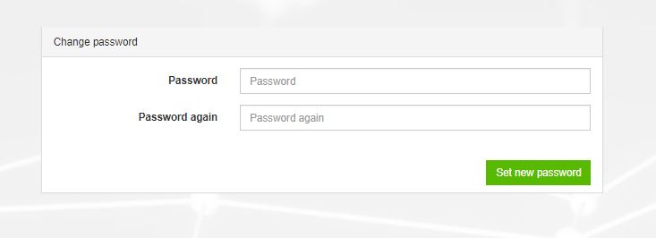
- you can reset your password using the "Forget password ?" link on the "Sign In" form if needed
User/Person profile
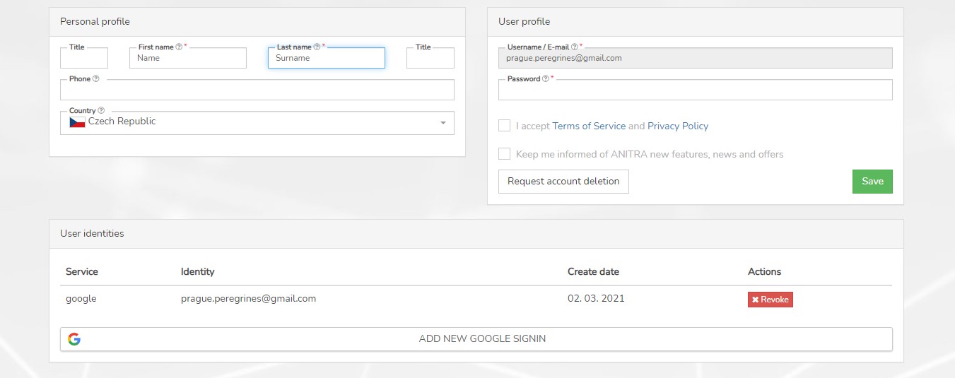
- You can modify personal details and preferences on your user profile detail
MAP
- The functionality displays all the Tracked Individuals available to a user (both owned/administered and shared only)
- By default an overview of the last positions is shown - the color of the point categorizes data by the last data update.
- Filtering functionality below the map limits data in the map and in the right Tracking selection list by following criteria:
- "Search" (full text search across Device/TO codes/names/aliases)
- Species
- Last "X" Days (limits all the data showing specified last X days interval)
- Other: Tracking Status, Country of Tagging, Current Age
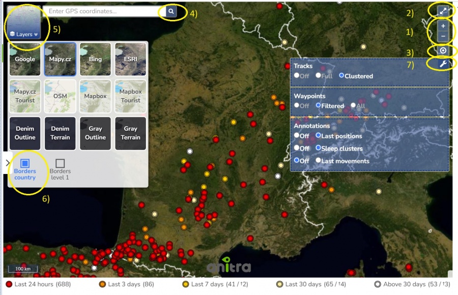
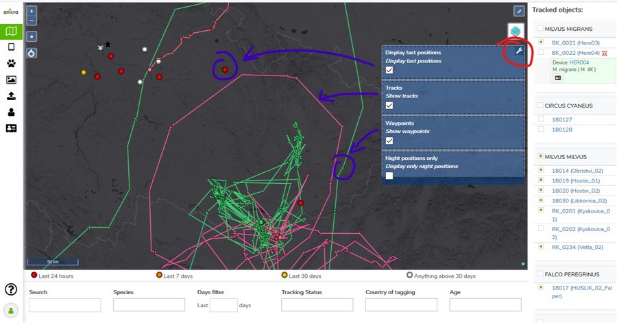
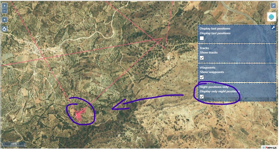
- Map functionality
- Tracking details
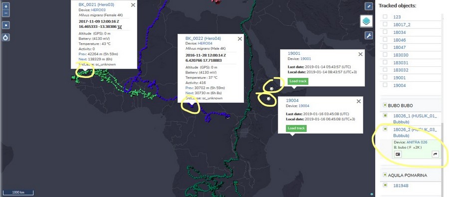
- Track point details in the tooltip (note that more track point tooltips can be displayed simultaneously)
- Additional Tracking detail in the right TO selection list (including "Share" button for admins)
- Click through the link to a particular Tracked Object profile
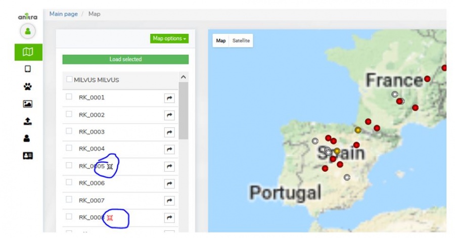
- Tracking Mortality Indicated by black/red symbols in the right Tracking side selection and in the tooltips
DEVICES
Device list
- List of owned or administered devices (= hardware)
- Click through to device details (profile)
- Available device types:
- "Anitra": used for Anitra native devices, device functionality includes remote control of active devices in the field
- "Ecotone": virtual devices for Ecotone data, the possibility of the data feed from Ecotone web (available on request)
- "Ornitela": virtual devices for Ornitela data, possibly of data feed on Ornitela web (available on request)
- "Upload/Basic": devices created through Import functionality, any other tracking data, the user who uploads become Device Owner
- Semi-automatic Device Status assignment: devices categorized into activity groups (archive, deployed, backup/stock)
- System of warning messages
- Incorrect/Missing Device-TrackedObject configuration: "Device Code" followed by the black/red exclamation mark ( "!" or "!" )
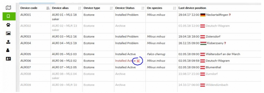
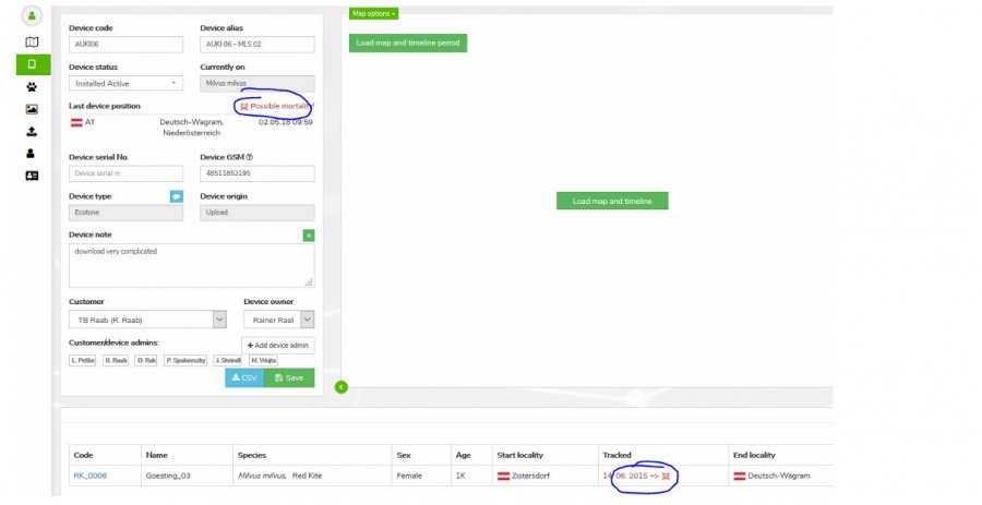
- Mortality indication: "Device Status" colored in red and followed by red skull symbol
- Missing data last X days: "Last Device Position" followed by red question mark "?". The mouse-over symbol tells the last data delay.
- Filter functionality: allows filtering your devices by criteria
- Manageable through Filter manager next to the Search box, marked with icon
- Predefined quick filters, which cannot be modified (Missing data in the last 7+ days, Anitra devices only, Powered off devices, Wrong tracking configuration, Deployed devices, Mortality indication)
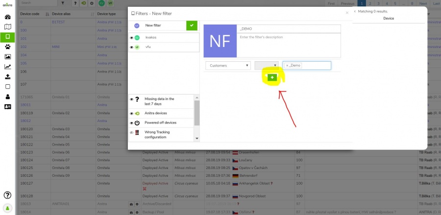
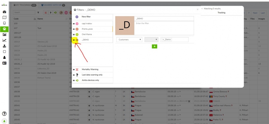
- Customized quick filters that filter devices according to specified criteria (e.g. Device list, Name fields, Device notes..), you can set multiple criteria at once
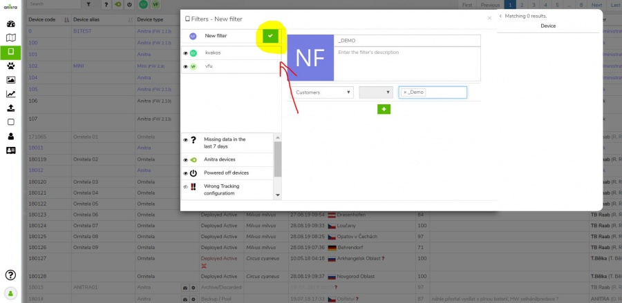
: - You can save your customized filter with the green "check" icon
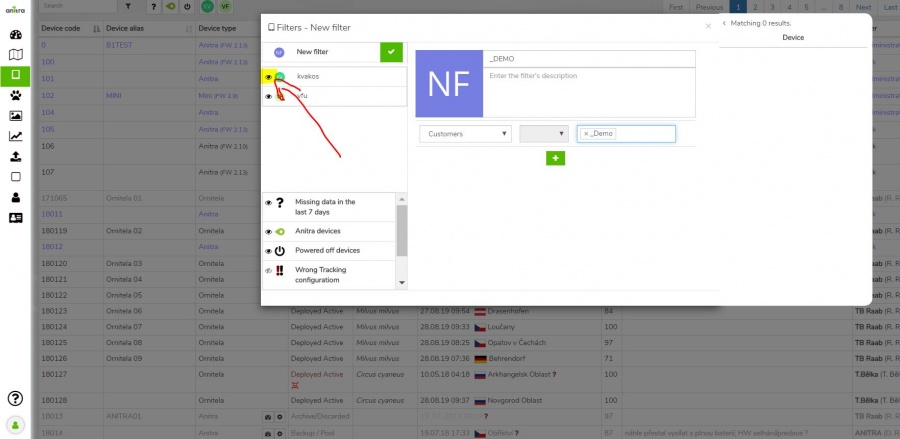
: - "Eye" icon enables to pin the particular Quick filter into the Quick filter panel next to the Search box
: - You can turn on multiple Quick filters at once in the Quick filter panel
- Device information (and configuration) is accessible only to owners/admins (users of shared data do not have the rights to see this data)
Device Profile
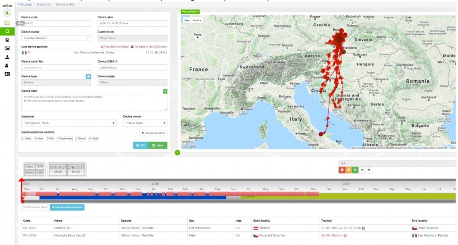
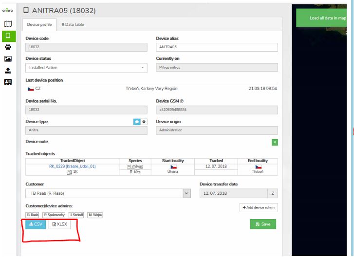
- Device identification, meta info, status, overview, and admin management
- Device data visualized on the map and on the timeline
- Definition of tracked animal (create, edit, delete)
- Removal of testing/manipulation/storage periods
- Creation/split of device data into real tracked animals (situation when one logger was subsequently used for more than one animal)
- Last known geolocation (DateTime + country etc.)
- System of warnings
- Incorrect/Missing Device-TrackedObject configuration
- Mortality indication: red/black warning in "Last device Position" row (red = for deployed and currently tracking devices/black = tracking finished)
- Missing data last X days: red warning in "Last Device Position" row (warning active just for deployed and currently tracking devices)
- Summary for related TO profiles including Mortality Indication symbols
Device Configuration
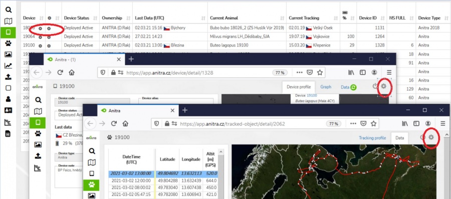
- Users with admin rights can access the configuration from the lists and profiles using cogwheel icons. Note the configuration functionality is available for Anitra devices only.
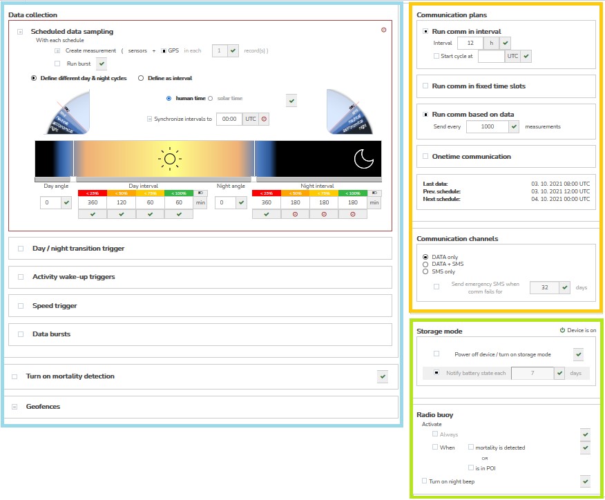
- Configuration contains three main areas
- Data collection settings
- GPS/sensor sampling time schedules
- Data collection triggered by events
- Configuration of bursting behavior
- Mortality detection adjustment
- Communication schedules
- Other settings
- Data collection settings
- For complete detail of all the configuration options see the configuration guide to the latest firmware version or to older versions respectively
TRACKED OBJECT (TRACKING+ANIMAL)=
Tracking List
- List of owned Trackings (tab "my trackings")
- List of Trackings shared with me (tab "shared with me")
- Overview of all Trackings including first and last data
- Click through to Tracking detail/profile
- System of warnings
- Mortality indication: "Tracking" followed by red skull symbol
- Missing data last X days: "Last Data " followed by red question mark "?". Mouse-over symbol tells the last data delay.
- Filter functionality: allows filtering your trackings by criteria
- Predefined quick filters, which cannot be modified (Mortality Warning, Last data warning only, Anitra devices only)
- Customized quick filters, which filter Trackings by set criteria (e.g. Tracked Objects, Name fields, Note fields..), you can set multiple criteria at once
- You can save your customized filter with the green "check" icon
- "Eye" icon enables to pin the particular Quick filter into the Quick filter panel next to the Search box
: - You can turn on multiple Quick filters at once in the Quick filter panel
Tracking Profile
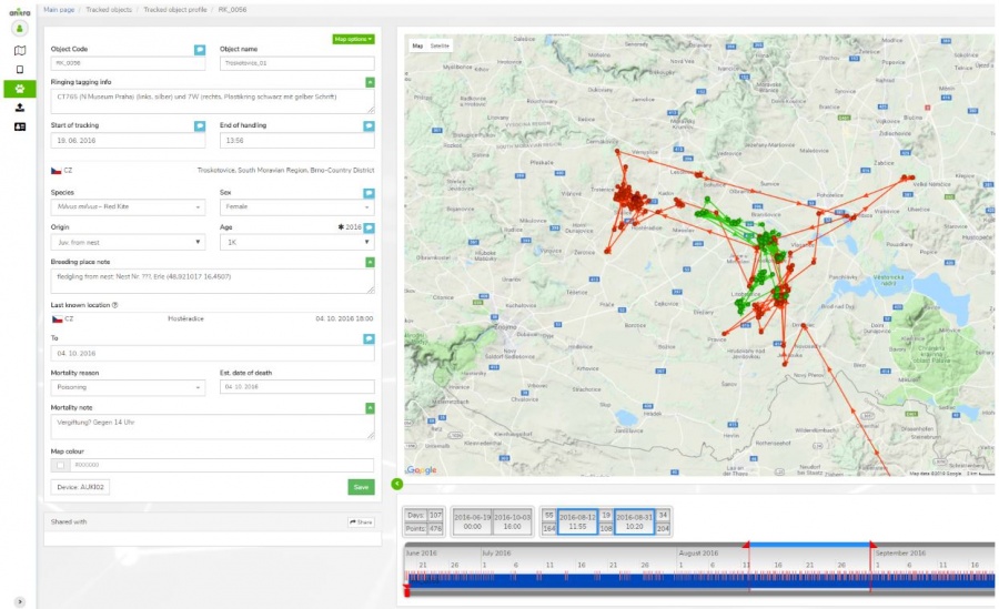
- Details of tracked object (= tracking of the individual animal)
- Identification (code, name, ringing, tagging, etc.)
- Info related to particular Individual (species, sex, age, origin)
- Info related to Start of tracking (including photo and file documentation)
- Info related to End of tracking (~ mortality/device failure)
- System of warnings
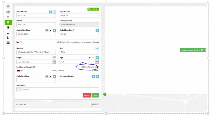
- Mortality indication: red/black warning in "Last known Position" row (red = for deployed and currently tracking devices / black = tracking finished)
- Missing data last X days: red warning in "Last Device Position" row (warning active just for deployed and currently tracking devices)
- "Share" button allows sharing Tracking to other Anitra users
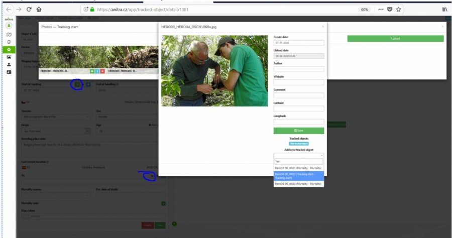
- Possibility to attach photos /documents related to
- Tracking start
- Mortality
- Same photo can be shared by various Trackings
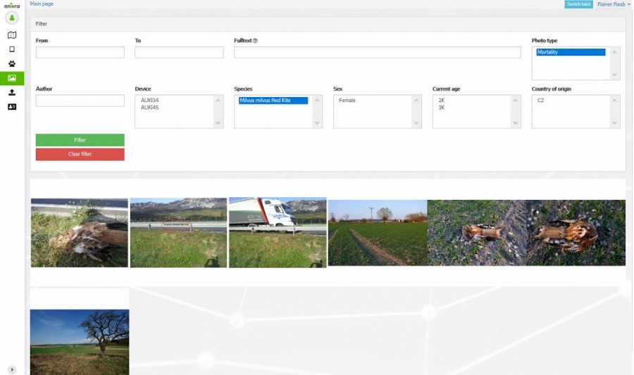
PHOTO GALLERY
- Displays a complete gallery of pictures from all the Trackings (own and shared)
- Filtering by main attributes
IMPORT DATA
- Allows importing any other tracking data in the predefined structure. Currently, we support:
- Data in simple structure device-GPSDateTime-latitude-longitude-note (type "Basic")
- Ecotone CSV format
- Ornitela CSV format
- "Upload" automatically analyses imported data and offers the creation of new "Devices"
- Data for already existing devices are appended to these devices (e.g. allows a user to update data in the system by monthly update files..)
- The user who uploaded data becomes Device Owner
ORGANIZATIONS (CUSTOMERS)
General overview
- a section visible in the side menu (only) for users with Admin/Owner relations to Organisations listed in the system.
- organization details such as contacts and access roles can be edited on the organization profile
- main customer admin (owner) is assigned
- owner can make other people admins granting them "customer admin" role.
- customer owner{admins) have full access to devices belonging to a particular customer/organization account (can export data, manage trackings and animals, etc.)
- a billing summary and payment history available in the Customer profile
- note the term "customer" refers to any "organization" having some kind of (active or past) commercial agreement with Anitra company
- the cost overview is typically visible upon initial invoicing is accounted
- various inbound and outbound data flows from manual to fully automated can be configured for organization account - see in detail below
- note owners of original data only are allowed to configure inbound data flows!
- Anitra works as a private storage and visualization place of those data only.
- any data uploaded manually or synchronized automatically to Anitra remain in ownership / full control of those who configured the flows
(IN) Inbound data feeds
- allows plugging to external telemetry data sources and having them fed into Anitra
- a unified metadata structure can be then created on top of the imported data (device - tracking - animal) so that data from various sources can be browsed and visualized together
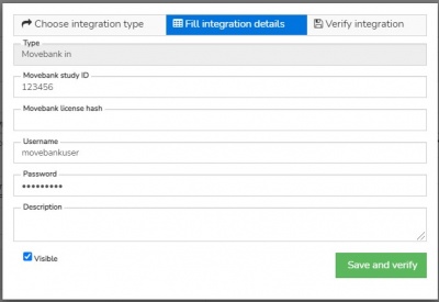
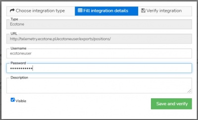
- a connector creation wizard
- can be triggered by the "+create new" button in integration sections
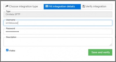
- allows requesting the feed activation after entering and validating username, password, and/or Study ID
- connectors for the following data sources currently exist:
(IN) Manual data import
- allows importing data files in the original structure and format into customer/organization profile (e.g. Ecotone CSV)
- usable e.g. for uploading older data files not available for automatic data flow anymore
- import dialog can be accessed in the left-side application menu using the "Import" icon
- for importing data in the particular customer profile (not in personal profile) make sure you chose one of your organization accounts in the "Upload in profile" selection
(OUT) Data export
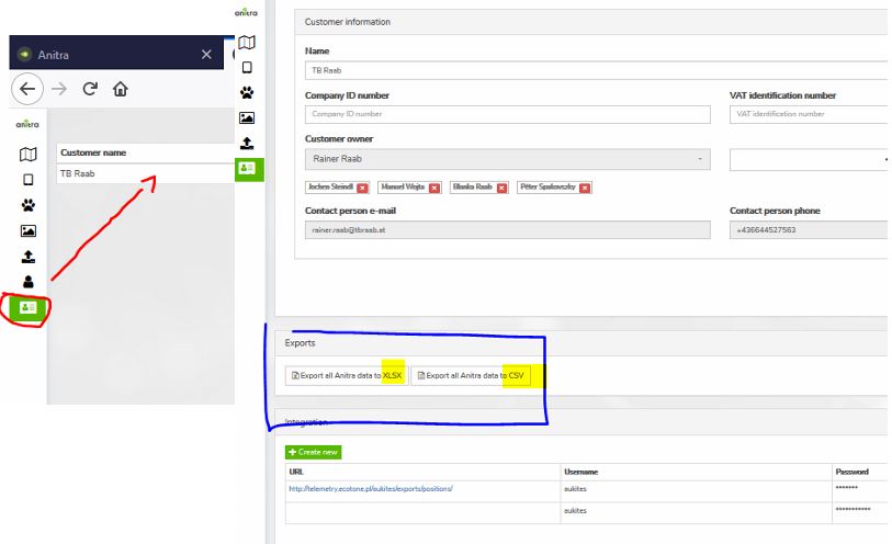
- allows manually exporting data from Anitra to CSV, XLSX, KML, or GPX formats for offline use
- the feature bulk exports data for all the devices belonging to the customer account
- data can be filtered by a date range
- the column editor feature allows modifying output columns in terms of columns list, column order, and naming of exported columns (a user preference)
(OUT) API data access
- allows grabbing Anitra data from external tools such as from GIS systems API interface
- service currently available on request only
(OUT) Anitra to Movebank data feed
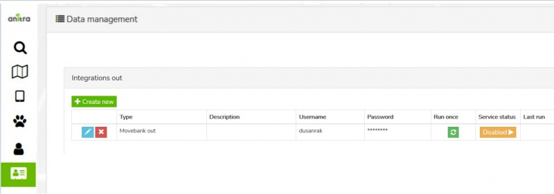
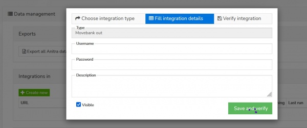
- Anitra to Movevebank data feed can be set up in the "integration out" section of the customer profile using the "+create new" button
- a Movebank data owner username needs to be specified.
- the account provided will be used to host all the synchronized data in Movebank
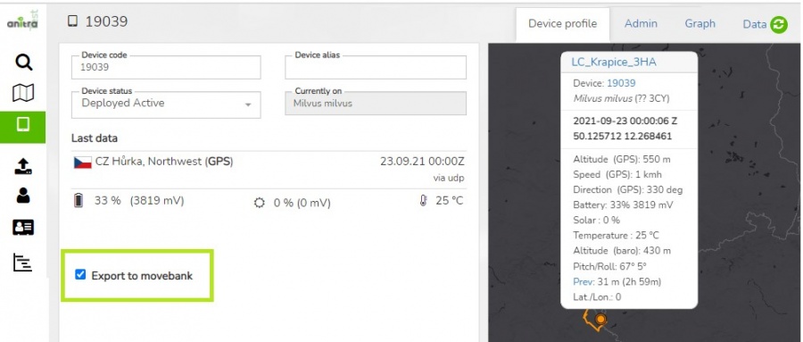
- you can switch ON/OFF particular tag data synchronization by the "Export to Movebank" checkbox in the device profile.
- by default the synchronization is inactive for all the new devices
- you can see the status of the check and the last time of synchronization of each of your devices at the device list
Published maps
- a tool to configure simplified and secured live telemetry maps from your full data sets
- configured maps are available in form of a link or in form of short HTML code which can be simply added to your web presentation or published on Facebook.
- maps can be created
- on top of single organization data
- or across more complex ownership structure of data shared within in "project"
- the functionality includes
- animal selection
- language variants
- tracks vs. last position modes, grouping options, ordering
- security features (security delay, zoom restriction, position "rounding")
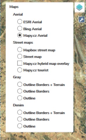
- presentation and visualization tools (a default map selection, icon/track styles, choice of icons, logos with links, foto gallery)
- a map editor with a live preview of the final map can be used to configure the map
- samples showing some of the map features
- map with tracks and gallery: https://app.anitra.cz/share/map/5d2e379ed6f9c
- map of last positions with categories: https://app.anitra.cz/share/map/5f1a97bb13ba5
- for more details see the complete guide to Published maps functionality
EXPORT DATA into CSV/XLSX/KMZ/GPX
- places to export data:
- Customer profile: full data for all ANITRA devices owned by Customer (available for CustomerOwner and CustomerAdmins)
- Device profile: all data for a single device (available for all Customer/Device Owner/Admins)
- Context menu from Device/Trackings list: all data for a single Device or Trackings (available for all Customer/Device Owner/Admins)
- /* mass data takeout not available for people with shared access only */
- Ref 1) Mass export ANITRA data on "Customer profile"
- Export columns specification:
- CSV file sample preview:
- XLSX file sample preview:
DEVICE-TRACKED OBJECTS-MORTALITY
- Anitra platforms data model is based on the following key concepts:
Device
- Represents physical hardware device to which all the tracking and sensor data are linked
- Allows storing info related to hardware (Brand, logger model, serial number, GSM no. etc.)
- The device in the system can be created:
- By purchasing Anitra logger (the device will be created and assigned to Anitra Customer)
- By importing tracking file (csv, kml/kmz, gpx)
- Automatically by Integration (i.e. automated data feed e.g. from Ecotone or Ornitela panels)
Tracked Object (or Tracking)
- Represents particular animal carrying logger device, a single device can be reused several times (in case of mortality of tracked object)
- Allows filtering (e.g. display, share) relevant subset of device data
- Allows attaching meta-information related to:
- The tracked Individual (species, sex, age, ringing, origin, etc)
- The tracking of that animal (start of tracking, end of tracking, mortality attributes, photos/documents)
- Tracked animal in the system can be created
- Using "split tracking" functionality in the device profile
- Using "create new tracking" functionality in the device profile
Device Data
- A basic level of tracking/measurement information
- Data are accessible through devices and their tracked object(s)
Device Status Management and Tracked Object configuration
- For maximum benefit of a full array of Anitra functionality (data filtering, mortality warnings, advanced sharing, etc.) we highly recommend to maintain "Device Statuses" for your devices and Tracked Objects for your study animals up to date.
- Available basic "Device Statuses":
- Backup / Pool:
- To be used for spare/pool devices which are not currently in the field and are planned to be (re)used in the future.
- New devices which appear in the system are labeled "Backup" status automatically
- Deployed:
- To be used for devices that are currently deployed "in the field" and potentially sending data
- There are 4 sub-statuses available that allow the user to configure Anitra behavior further
- Backup / Pool:
- 1. Deployed Active:
- Known to be currently delivering data reliably and new data expected to be updated on a regular basis
- Mortality notification should work reliably
- 2. Deployed Down:
- Known to be still delivering data (at least for some time), but based on data received the device very likely not already attached to the target animal (shed/down logger, the killed animal)
- Hardware to be either recollected or written-off
- "New data" notifications could help investigate the case until the logger transmits data
- After collecting all possible information and closing the case the device should be turned to "Archive" status
- 3. Deployed Missing:
- Data delivery suddenly interrupted, last positions do not show animal/logger issue
- "New data" notifications possibly used to notify on the restoration of data transfer
- 4. Deployed Problem:
- Depending on the issue type the data delivery fails or some sensor data might be unreliable
- Allows suppressing mortality notification as false or confusing warnings may be raised
- 1. Deployed Active:
- Archive / Discarded:
- meant for "out of use" devices (inactivated, suspended, finished) not expected to deliver any new data
- Turning device into this state allows suppressing warning scheme
- Allows to store and filter out archive data
- Note that devices created through import functionality are by default switched to this state
Tracking EndDate
- Device Statuses are meant to help to control active Loggers >> Tracked Objects (Trackings). In order to receive a meaningful warning, it is highly recommended not only to turn inactive devices to Archive but also to end related active Tracked Objects (Trackings) whenever the tracking in the field is over (i.e. you do not expect to receive any new data).
- Ending Tracked Object / Tracking is done by filling in date into field "End of tracking" in the Tracking profile
- "End Of Tracking" field leaves space for individual interpretation. For instance in case of mortality you can include the period when the tracked individual was alive only or you might as well close the tracking date later when the device was physically found and removed.
- Note that you can additionally enter more detail related to mortality event ("Estimated date of death", "Mortality Reason", "Mortality Note", "Mortality Photos/Documents/Reports")
- Notifies on possible mortality in the last position of finished (archive) trackings
- You can set the end date of tracking so that the mortality sign is displayed in your archive data (see the end date for the first two tracked objects in example no 1)
- Warns on possible mortality detected in the last position of active trackings
- In order to have relevant red warnings shown correct device/TO configuration needs to be kept by project admin
- Note. the detection of mortality is currently based on
- Anitra: dedicated sensor/accelerometer mortality detection logic
- Ornitela: identical body position between subsequent measurements
- Ecotone Activity column with a simple rule (Activity < 10) triggering the alert. More complex logic is being developed for Anitra native devices
- You can find these last data mortality warnings on various screens of the Anitra platform:
- Device list (only Red warning for Active trackings)
- Device Profile
- Tracking List (both Red warnings for Active trackings and Black Info for Archive trackings)
- Tracking profile
- Map (both Red warnings for Active trackings and Black Info for Archive trackings)
- Device Owner/Admins can freely switch devices from one state to another and modify Tracking end dates in order to achieve desired Anitra behavior
