Map/default/en
MAP:
Note: functionality is gradually extended and elaborated significantly at the moment
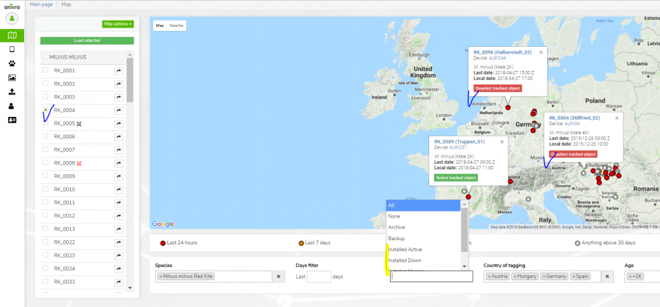
- allows seeing all the Tracked Objects (birds) available to the user in one map (both owned/administered and shared only)
- by default displays last known position for all tracked individuals (color of points categorize last data update)
- filtering functionality below the map optionally limits map data and left selection list by
- Species
- Last "X" Days
- Tracking Status
- Country of Tagging
- Current Age
- Left side selection and/or map tooltips allows picking one or more individuals to analyze detailed tracking data in parallel ("Load selected" button)
- Note that "Days filter" filters period for loaded full tracks (i.e. Last 50 days selection will load tracks for the last 50 day for all the chosen Tracked Objects)
- Mortality Indicated by black/red symbols in Tracked Object left side selection
<figure-inline> </figure-inline>
- Other map functionality
- map/track options
- Clusters
- Arrows (=direction)
- Points
- Tracks
- Full-screen view
- click through to particular Tracked Object profile (mouse double click in the same tab or open in a new tab by mouse wheel button)
- map/track options
- different color auto-assigned to each TO (possible to override in the TO profile)
- Track point details in the tooltip for one (or more) track points
- "Share" button available for admins