Points of interest and events
Telemetry tells you where an animal was. Points of interest and events tell you what was there: a nest, a wind turbine, a known poisoning place, a check somebody carried out in the field. They are stored alongside the telemetry and drawn in the same map, from the left panel described in the main map section.
The panel works on its own, so these datasets can be browsed over an empty map without loading any tracking first.
What a POI, an Event and Geography are
Point of Interest (POI) is a place that matters to your work - a nest site, a wind turbine, a power pylon, a known poisoning location, a roost site. Every point has a type, which decides the branch it appears under in the panel and the icon it is drawn with, a shape (a single point by default), a name, a comment and a position.
Event, also called an Observation, is something that happened at a place and time. An event belongs to a point of interest and carries its author, the date and time, a comment, the location, the number of individuals seen and photographs.
Geography is the administrative hierarchy - country, region (admin1) and district (admin2). It is used in two different ways in the panel: the by Geography tree groups points by the area they fall into, while the separate Geography branch draws the borders of those areas and contains no points of its own.
Points of interest and events each have their own splits in the panel. Points are browsed by Geography, by Group or by Type, events by Date, by Animal/Tracking or by POI, and every branch carries the number of items it would show.
Creating a point of interest
A point is created in the map, at the place it belongs to.
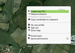
- Right-click the map where the point should be and choose Create new POI from the
context dialog.
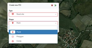
- Set the POI type - this is what puts the point into a branch of the tree - and the
object shape; a point is the default.
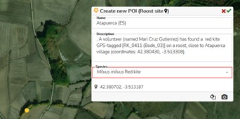
- Fill in the name, your comment and the species it concerns, and adjust the location in the map if needed. The Style icon changes the colour of the map placemark.
- Confirm with the green check in the top right corner of the dialog.
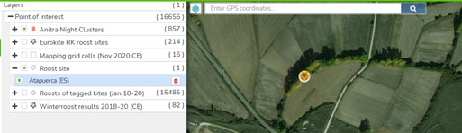
A type that had no points before appears in the left panel as a new browsing path as soon as the first point of that type exists.
Recording an event at a point
An event is always added to a point of interest, using the icon in that point's detail.
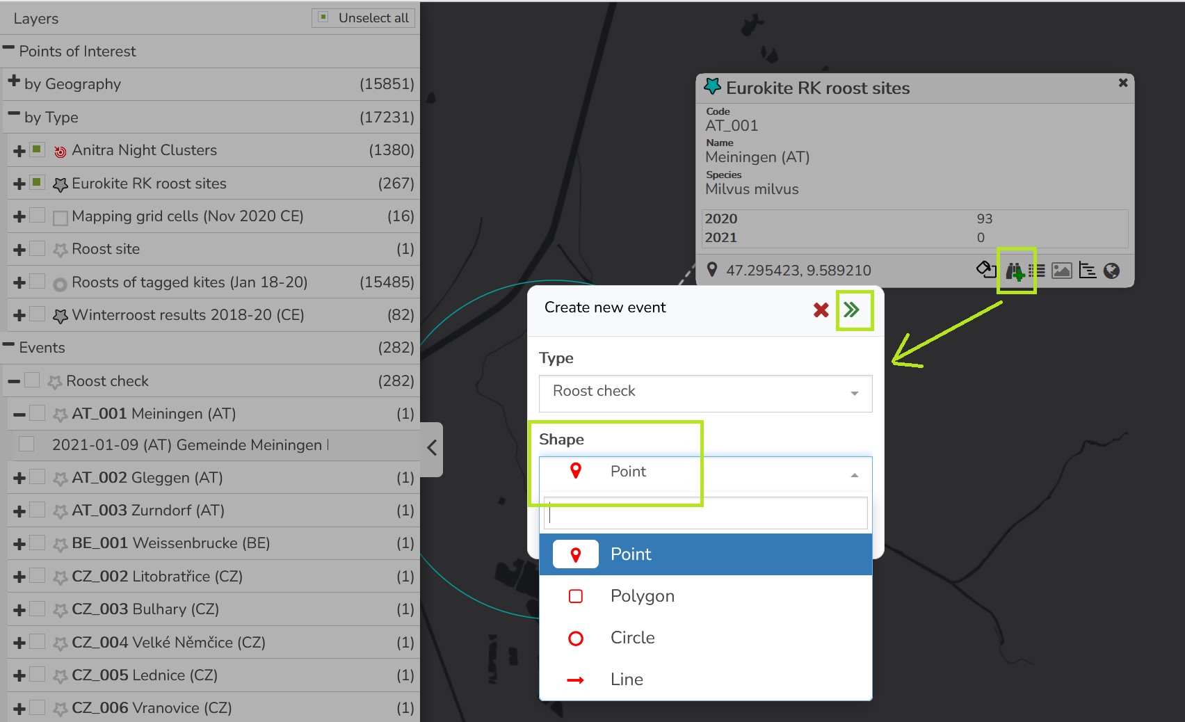
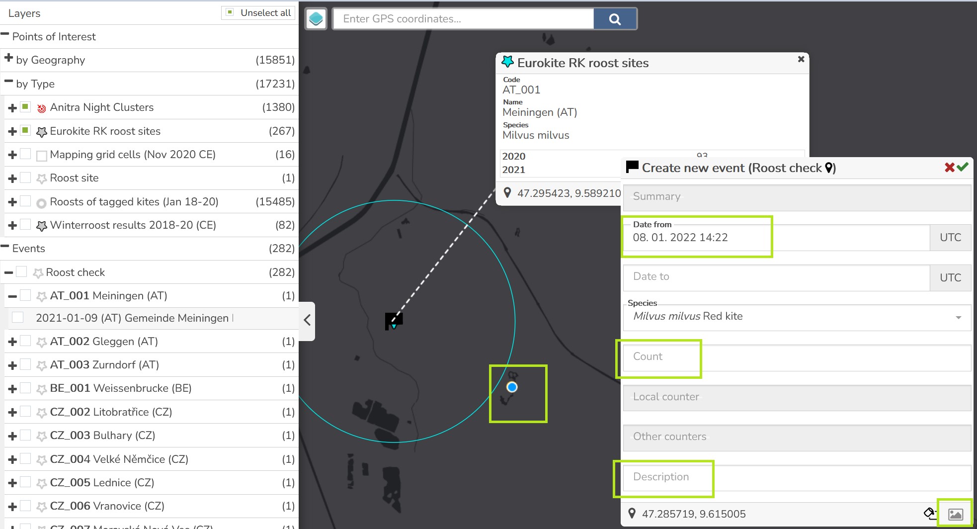
The author is filled in automatically; the rest of the record is the date and time, a comment, the actual location, the number of individuals and photographs.
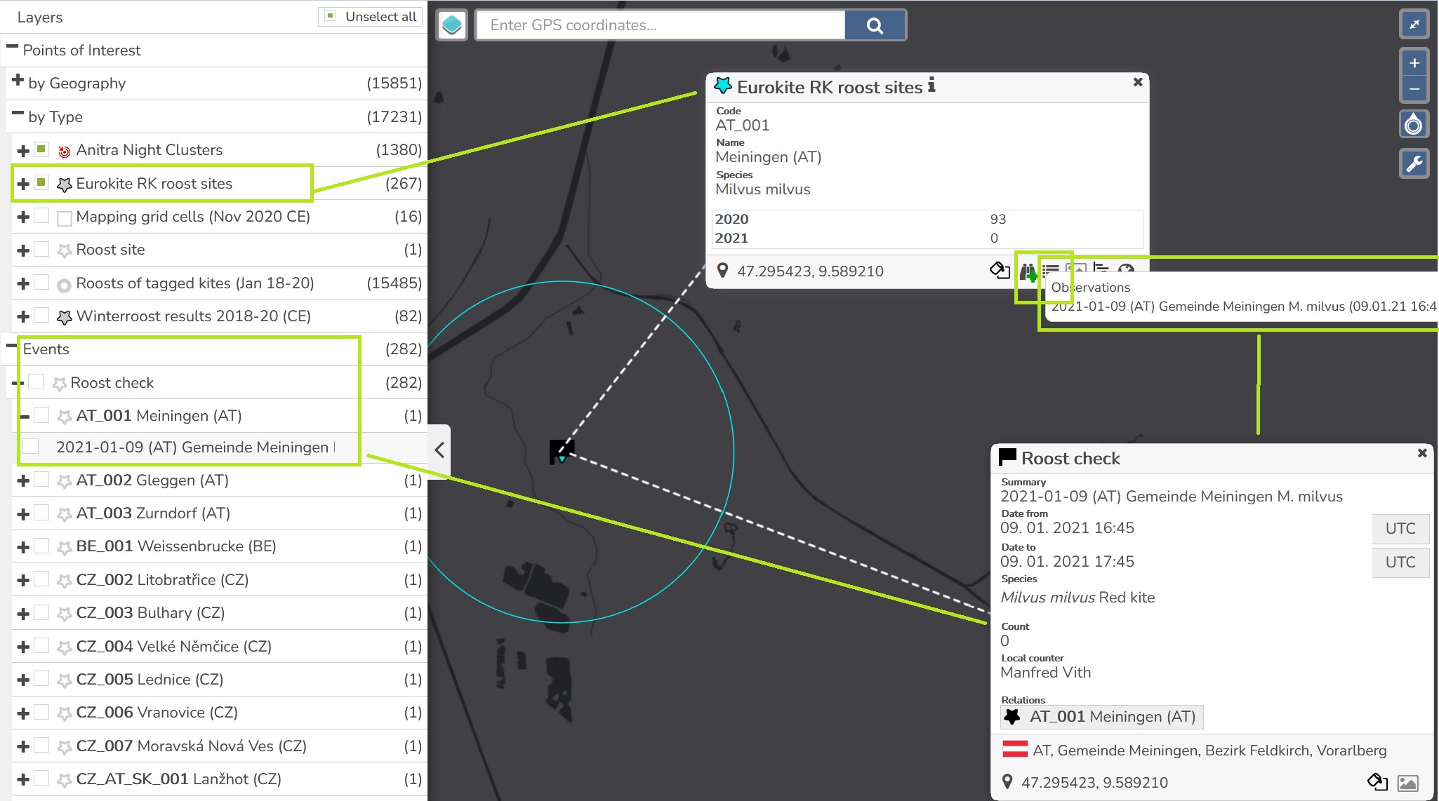
Saved events are then in two places: in the Events tree of the panel - where they can be browsed by date, by the animal or tracking they concern, or by the point they belong to - and in the history log of the point itself.
Editing and deleting
Hovering over a point or an event shows its information, a left click opens and pins it, and a double click opens edit mode for the objects you may edit.
Deleting is offered from any of the three trees. Some points cannot be deleted - typically because an event is linked to them - and the application tells you which reason applies rather than failing silently.
Changing the type of a point moves it from one branch of the tree to another; the panel rebuilds itself, so what is ticked in the map keeps agreeing with what is in the tree.
Who sees and edits what
You can edit and delete the points and events you created yourself; a point belonging to somebody else opens read-only.
Points of interest can belong to a group, which is how they are shared with other people - the by Group tree of the panel browses points by the dataset they belong to.
Some of the datasets in the panel are shared and read-only, such as the night clusters Anitra computes or the wind turbines. They come with the projects you take part in, and taking part in a project is enough to see them.
The same point can appear in more than one tree at once, and showing or hiding it anywhere takes effect everywhere.